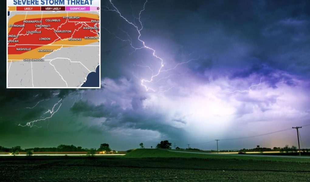
The FOX Forecast Center is tracking the threat of large hail and damaging winds Saturday that could impact more than 40 million residents from Missouri to the foothills of the Appalachians.
The Storm Prediction Center has highlighted eastern Missouri, Illinois, Indiana and western Kentucky for being in an enhanced risk for storms.
The SPC expects thunderstorms from overnight to weaken, but more rounds will develop during the afternoon and evening.
Any storm that develops where there is plenty of instability and moisture has the potential to produce winds over 58 mph and hail at least the size of a quarter.
“The storms get worse and more widespread through Saturday, late afternoon, and they continue all the way into Saturday night across the entirety of this area. So be very weather-aware Saturday into Sunday morning since you’ve gotten a lot of rain recently, and you’re expecting a whole lot more. You’ve got a likely threat for some flash flooding in this location as well,” said FOX Weather meteorologist Kelly Costa.
Communities in the zone where severe weather is likely include St. Louis, Missouri; Springfield, Illinois; Evansville, Indiana; and Louisville, Kentucky.

Recovery from 500-mile derecho continues in Midwest
Some communities are approaching 48 hours since storms knocked out power on Thursday.
A line of thunderstorms known as a derecho raced across the Midwest producing winds upwards of 100 mph and causing at least 500 reports of severe weather.
According to data provided by PowerOutage.us, at least 200,000 outages are still active, from Missouri through Illinois and Indiana.

Local energy providers say they brought in extra crews to reduce restoration times.
Duke Energy, which covers a large part of Indiana and southwest Ohio, reported restoring power to at least 108,000 customers since the storms rolled through.
The mayor of Springfield, Illinois, declared a local state of emergency due to the extent of the damage and utility crews estimated it could be at least Sunday before all homes and businesses in the state capital have power.
Sunday forecast
The disturbance responsible for the latest round of wet weather will only slowly budge eastward on Sunday, meaning many areas will see the threat for a couple of rounds of showers and storms.
The highest threat for severe weather during the second half of the weekend extends from the Mississippi River to the Eastern Seaboard.

Communities such as Louisville, Kentucky; Cincinnati; Washington, D.C.; and Baltimore are all included in Sunday’s risk zone.
The SPC does not expect severe storms to be as widespread as they were on Saturday but warns that a few cells could produce gusty winds and hail.
𝗖𝗿𝗲𝗱𝗶𝘁𝘀, 𝗖𝗼𝗽𝘆𝗿𝗶𝗴𝗵𝘁 & 𝗖𝗼𝘂𝗿𝘁𝗲𝘀𝘆: nypost.com
𝗙𝗼𝗿 𝗮𝗻𝘆 𝗰𝗼𝗺𝗽𝗹𝗮𝗶𝗻𝘁𝘀 𝗿𝗲𝗴𝗮𝗿𝗱𝗶𝗻𝗴 𝗗𝗠𝗖𝗔,
𝗣𝗹𝗲𝗮𝘀𝗲 𝘀𝗲𝗻𝗱 𝘂𝘀 𝗮𝗻 𝗲𝗺𝗮𝗶𝗹 𝗮𝘁 dmca@enspirers.com


